Maine / New Hampshire / Vermont, Maine
Maine / New Hampshire / Vermont, Maine State Map
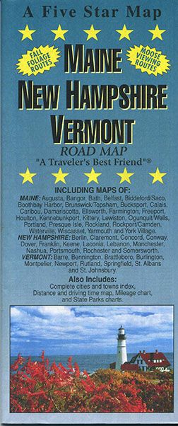
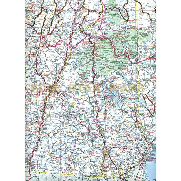

Map Coverage Area
Maine: Augusta, Bangor, Bath, Belfast, Biddeford/Saco, Boothbay Harbor, Brunswick/Topsham, Bucksport, Calais, Caribou, Damariscotta, Ellsworth, Farmington, Freeport, Houlton, Kennebunkport, Kittery, Lewiston, Ogunquit/Wells, Portland, Presque Isle, Rockland, Rockport/Camden, Waterville, Wiscasset, Yarmouth, and York Village
New Hampshire: Berlin, Claremont, Concord, Conway, Dover, Franklin, Keene, Laconia, Lebanon, Manchester, Nashua, Portsmouth, Rochester and Somersworth
Vermont: Barre, Bennington, Brattleboro, Burlington, Montpelier, Newport, Rutland, Springfield, St. Albans and St. Johnsbury
Complete cities and towns index, Distance and driving time map, Mileage chart, and State Parks charts
Publisher
Five Stars MapsAuthor
Five Star MapsSize / Page Count
27x32Finish Size
4x9ISBN Code
978-1-59214-021-3UPC Code
7-68306-11316-8Copyright
2014Scale
1.4m$4.95